Places & Spaces
The ‘Places/Spaces’ below are a selection of proposed locations that could be utilised by you in your proposals. However, the whole town of Gorey is open for your proposals and therefore, we would suggest you use the map links (see below) to travel through our town and familiarise yourself with its ‘nooks and crannies’. We have used a combination of photographic and sound documentation below to give you a little insight into our community.


Circe Pavilion
Civic Centre, the Avenue, Gorey
The Circe Pavilion, designed by Donal Cofer is currently on loan to Wexford Co. Co. It was originally launched in Dublin by Mary Cremin & Oonagh Young, directors of the Treeline Project.
Its intention is to create an open space that can be used by any group. The pavilion promotes the use of public space as an area for all disciplines of art, community groups, critical thinking and cultural and ecological activism.
It is presently located at the Civic Centre which is home to the district council, courthouse, library, HSE, VEC and public housing.
View on MAP
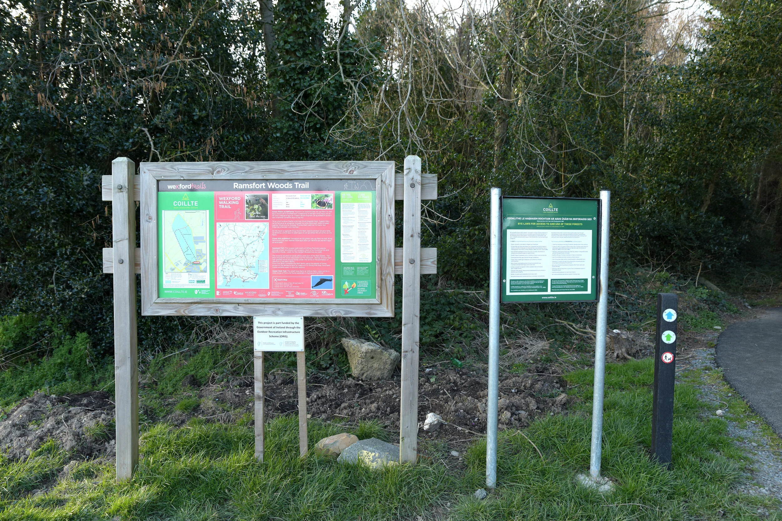


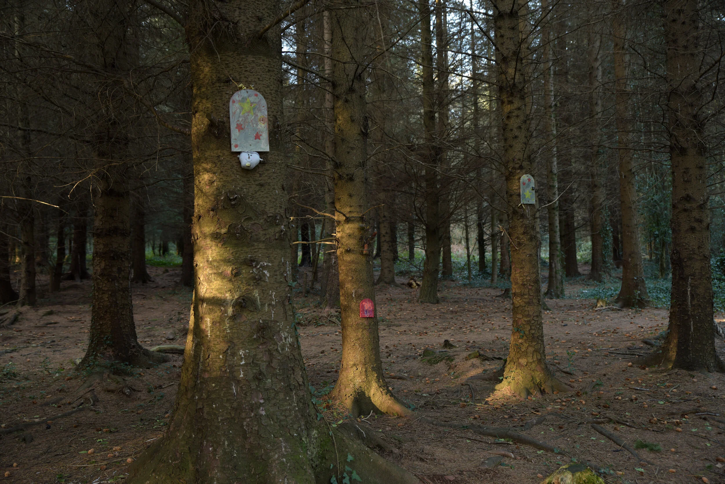


Ramsfort (Gorey) Woods
Ramsfort, Gorey
The Ramsfort Park is a new woodland walk in Gorey which was officially opened by members of Gorey Municipal District and representatives from Coillte. It is located at the edge of Gorey town.
The walk features as part of the Wexford Trails, which is part of the national network of trails in Ireland. The wood is situated on lands which were part of the Ram Estate and is a mixed woodland with occasional views of surrounding hills and Ramsfort House. While here, you can also listen for the resident buzzard as you walk.
View on MAP


Market Square
Market Square, Gorey
The Market Square is a transient space. Officially designated as the ‘casual trading area’ of the town, it does facilitate a small weekly market. However, this market has reduced in size over the years. Presently, it is dominated by the automobile and mainly used for car-parking purposes.
The space is located between the offices of the local newspaper and the grave of Bishop Thomas Ram. It is close to the Main Street and facilitates walkways to the Town Centre, the Avenue and Civic Centre.
It featured predominantly as a space/place for development in Gorey’s previous Public Realm Plan and is due to link to the new development of the Market House. View on MAP


St. Michael’s CEMETERY & Marian Shrine
Courtown Road, Gorey
St. Michael’s Cemetery and the adjacent Marian Shrine are both located on the Courtown Road. The Cemetery is the property of the Roman Catholic Parish in Gorey and is for the burial of deceased members of the parish; in accordance with the beliefs, traditions and practices of the Roman Catholic Church.
Rising in height, the Cemetery reveals a wonderful skyline looking out across the town. The graveyard has entrances on both the Courtown and Clonattin Road.
There are extensive records kept about the Cemetery and some of these can be accessed here:
View on MAP


Gorey Train Station
Knockmullen, Gorey
Wexford was one of the last counties in Ireland to have a railway - only Sligo, Leitrim and Mayo followed. This was largely due to the Wicklow and Blackstairs Mountains being difficult to engineer a railway through.
Gorey train station is located off the Avenue and opposite Gorey’s Shopping Centre. Its main line connects the town with Dublin City and the station contains a single-span footbridge over the railway line, dated from 1891.
View on MAP


The Magic Garden
Coach Road, Gorey
An Gairdín Draíochta, The Magic Garden, on the Coach Road, is just one of the many projects developed and maintained by Gorey Tidy Towns. This garden is in an interesting spot, located between the multinational enterprise Aldi and Turas Nua, who operate the countries controversial job activation programme; ‘JobPath’.
The garden itself is beautifully kept and is a haven for butterflies, insects and bees. It was funded by the Local Agenda 21 Environmental Partnership Fund, Wexford County Council and Gorey Town Council.
View on MAP


The Old Ball Alley
Wexford Street, Gorey
The old Ball Alley in Gorey was located on Wexford Street, adjacent to the old Christian Brothers Primary School. It could also be accessed from the Avenue via a narrow lane.
From the 1880s to the 1970s handball was a popular sport in religious and military institutions. Most seminaries, secondary schools, psychiatric hospitals, RIC barracks (and later Garda stations), army barracks and fire stations typically contained multiple alleys.
The Ball Alley in Gorey was eventually sold to Wexford Co. Co. and now exists as a small car park. The lane was and still is a popular place for students and young people in Gorey to ‘hide & smoke’.
View on MAP


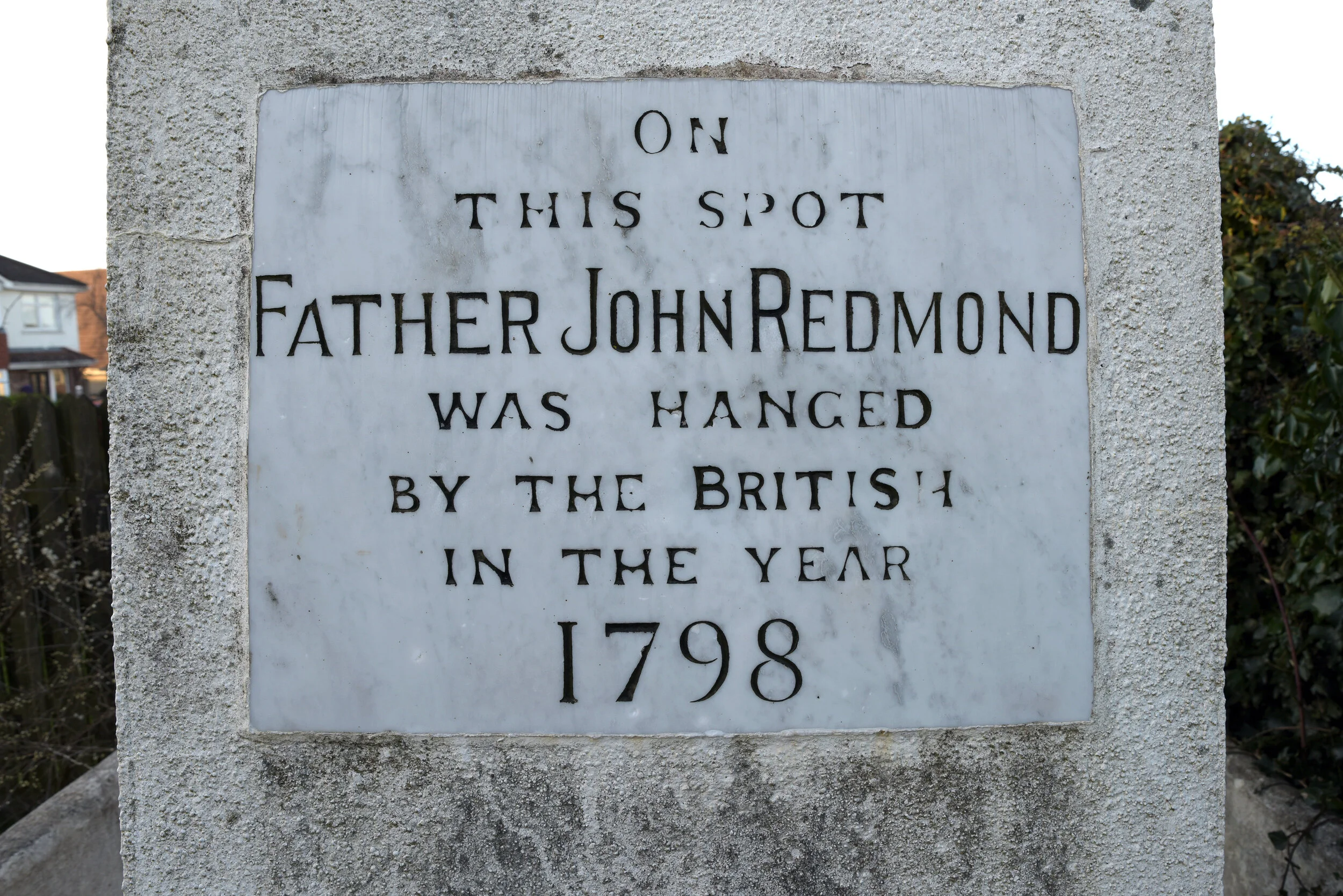


Fr. John Redmond Monument
Gorey Hill, Gorey
John Redmond was born into a modest Catholic farming family in Ballinakill, in north-western County Wexford. By the end of June 1798, the devastated County of Wexford was under British military control with some hard-line loyalist elements desiring vengeance against former neighbours.
Redmond was summoned to the town of Gorey by Lord Mountnorris. Upon walking into the town, Fr. Redmond, believing to be safe, due to his vocal protests of the rebellion was immediately manhandled, kicked and beaten by local Orangemen, under the command of Hunter Gowan. He was marched up towards Gorey Hill, one of the principal campsites of the Wexford Northern Division of insurgents. Here, Redmond was hanged alongside an insurgent named Patrick Carroll. View on MAP


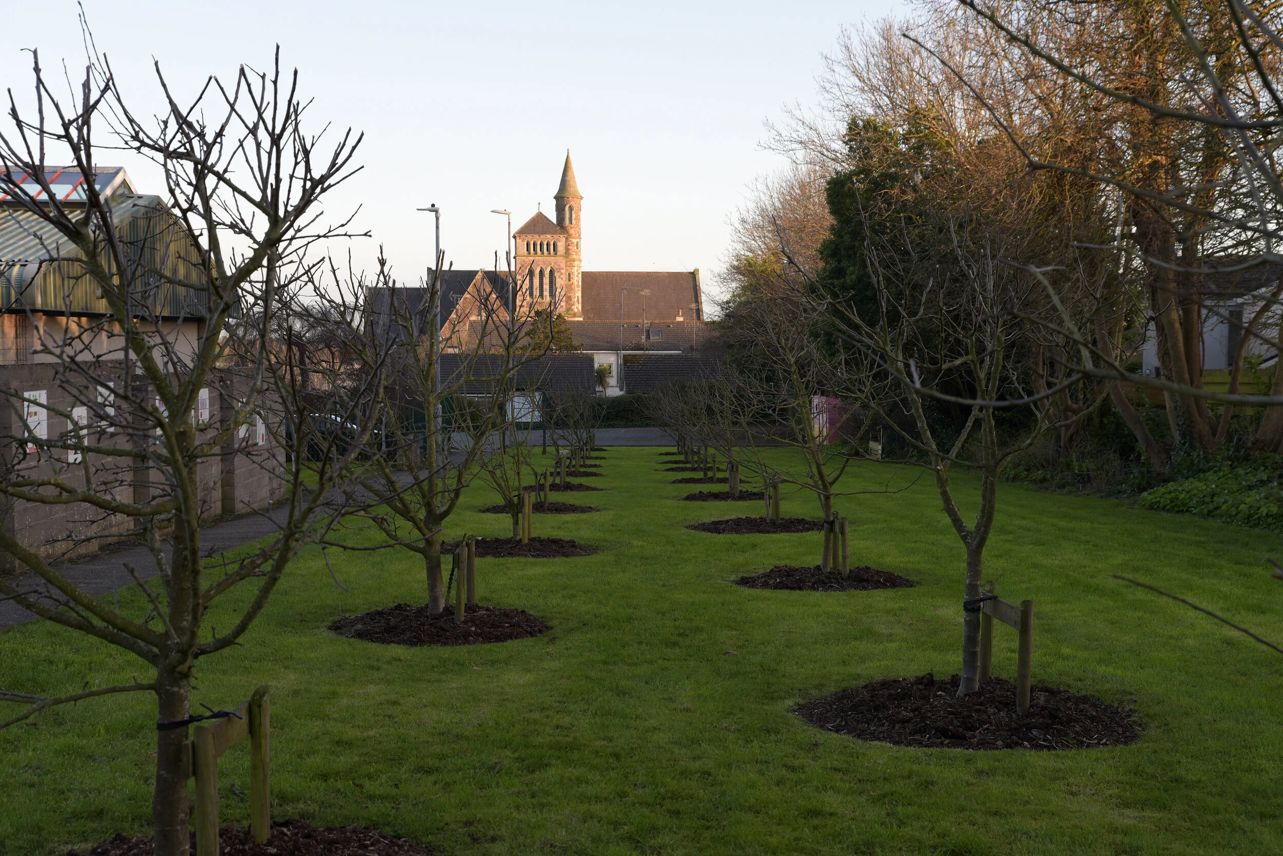


Community Heritage orchard
Sean Lois, Gorey
Historically there have always been orchards in and around the town of Gorey. This orchard was proposed, planned and planted in two stages (spring 2012 & 2013) by the Gorey Tidy Town volunteers with the assistance of the Gorey Men’s Shed. The orchard is essentially a public amenity, which invites the community to wander through its trees and during harvest time, to pick and enjoy its fruits.
There are 21 trees planted here; 19 apple and 2 plum. They are all traditional varieties and were sourced from the Irish Seed Savers Association.
It is currently located only meters from two historic orchards; one which was located on the site of the adjacent Fire Station and the other on the land of the old Rams Hotel. View on MAP